
Municipal leaders face a constant challenge: aging infrastructure, growing populations, tighter budgets, and the pressure to make every capital investment count. Geographic Information Systems (better known as GIS) have become one of the most powerful tools available to help communities meet that challenge head-on.
Today, forward-thinking engineering and planning teams are integrating GIS technology across the full project lifecycle, from early planning through long-term maintenance. Here’s a look at how GIS is reshaping infrastructure work from the ground up.
What Is GIS, and Why Does It Matter for Municipalities?
GIS is a technology that captures, stores, analyzes, and displays geographic and spatial data on maps. Think of it as a living, layered map that connects location to information, including the age of a water main, the condition of a road surface, or the boundaries of a floodplain.
For municipalities, GIS brings clarity to complexity. Instead of sifting through paper records, spreadsheets, and separate databases, decision-makers can see everything they need in one place, visually and in context.
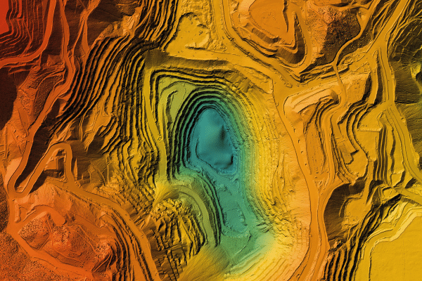
Planning: Smarter Decisions Before the First Shovel Hits the Ground
One of GIS’s greatest strengths is its ability to support better planning. When a municipality is considering a new road, a stormwater improvement, or a utility expansion, GIS allows engineers and planners to:
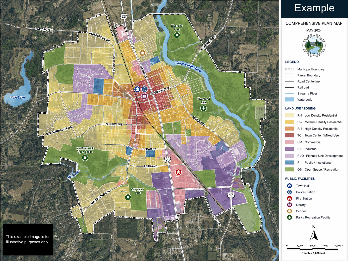
- Layer existing infrastructure over environmental data, zoning maps, and topography to identify conflicts or opportunities early
- Model growth patterns to understand where population or traffic demand is heading, and plan accordingly
- Analyze environmental constraints such as wetlands, floodplains, and steep slopes before a project scope is finalized
- Evaluate multiple project alternatives side-by-side using real geographic data, not just assumptions
This kind of spatial analysis reduces surprises during design and construction, which ultimately saves time and money for the municipality and its residents.
Design and Construction: Precision at Every Stage
GIS doesn’t step aside once planning is complete. During design, GIS data feeds directly into engineering workflows. Accurate base mapping, utility conflict identification, and as-built record integration all benefit from a robust GIS platform.
For construction coordination, GIS helps project teams:
- Communicate clearly with contractors, inspectors, and the public using intuitive maps rather than complex engineering drawings
- Track project progress geographically, so stakeholders can see exactly where work is happening and what’s been completed
- Coordinate utility relocations by identifying conflicts with buried infrastructure before they become costly change orders
The result is fewer miscommunications, more efficient construction sequences, and a better-documented project record when the work is done.
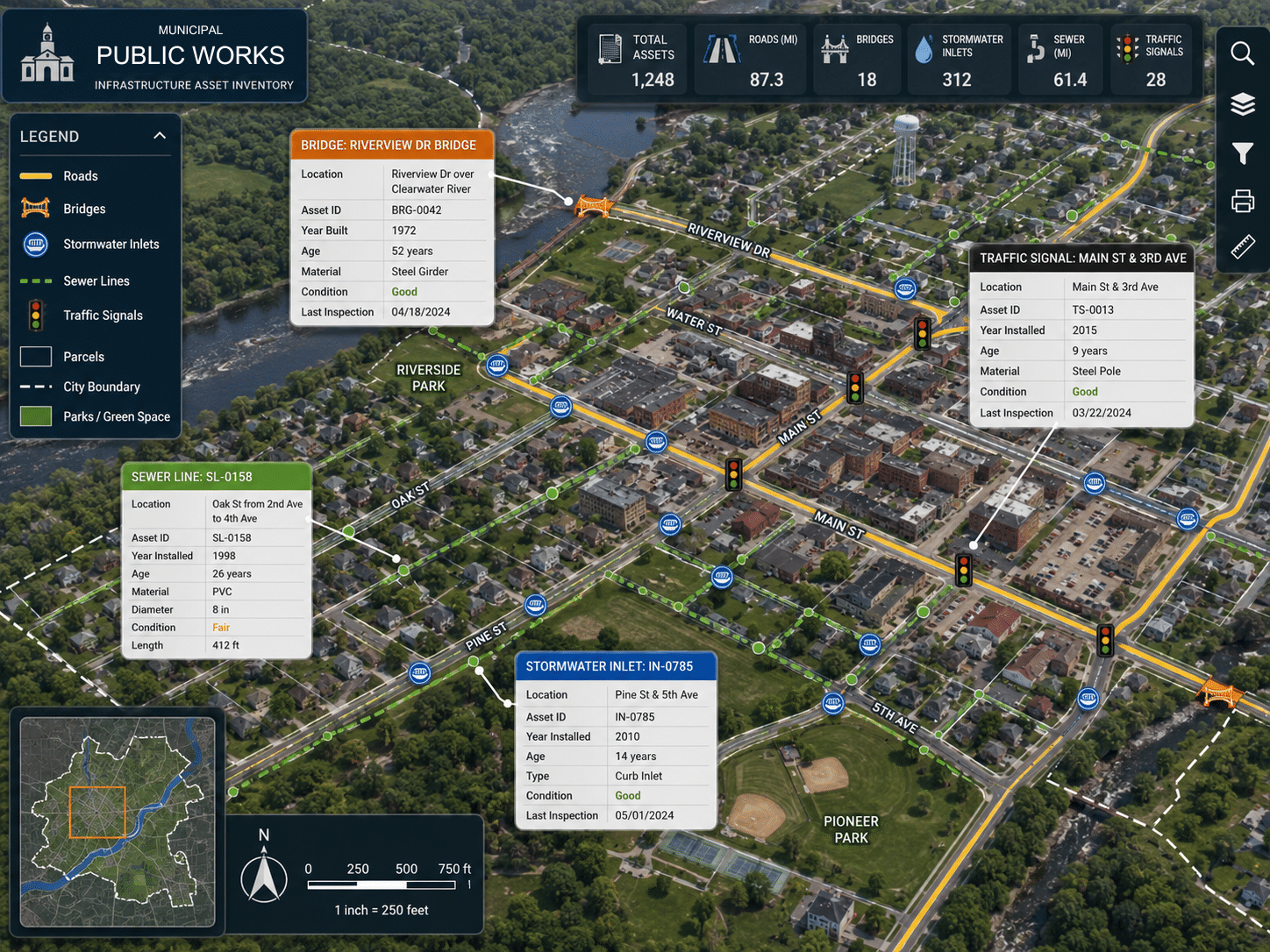
Asset Management: Maintaining What You’ve Built
Building infrastructure is only half the battle. Maintaining it over decades requires knowing what you have, where it is, and what condition it’s in. This is where GIS delivers some of its most tangible long-term value for municipalities.
With a GIS-based asset management system, public works departments can:
- Inventory every asset including roads, bridges, stormwater inlets, sewer lines, and traffic signals, with location, age, material, and condition data attached
- Prioritize maintenance and replacement based on condition ratings and lifecycle data rather than squeaky wheels or guesswork
- Track maintenance history so crews know what was done, when, and by whom
- Model future needs and build defensible capital improvement plans to present to council and the public
Communities that invest in GIS-based asset management typically reduce emergency repair costs, extend the life of existing infrastructure, and make a stronger case for capital funding.
Emergency Response and Resiliency Planning
GIS also proves invaluable when things go wrong. Whether it’s a major storm, a water main break, or a flooding event, GIS helps emergency responders and municipal staff:
- Quickly identify affected areas and infrastructure
- Route crews efficiently to the right locations
- Communicate with the public through web-based maps
- Document damage
And when it comes to long-term resilience, including planning for flooding, sea level rise, or aging infrastructure, GIS provides the spatial foundation for meaningful analysis and proactive investment.
Public Engagement: Showing Residents the Full Picture
One underappreciated benefit of GIS is how it improves communication between municipalities and their residents. Interactive web maps allow the public to:
- See where infrastructure projects are planned or underway
- Understand why certain areas are being prioritized
- Report issues like potholes or drainage problems directly through map-based tools
When residents can see what’s happening and why, they’re more likely to support the investments their community needs.
Frequently Asked Questions About GIS and Municipal Infrastructure
What does GIS stand for, and what does it do? GIS stands for Geographic Information System. It is a technology that links data to specific locations on a map, allowing municipalities to visualize, analyze, and manage information about their infrastructure, environment, and community in one place.
Do smaller municipalities have the budget for GIS? GIS is scalable and does not require a large upfront investment to get started. Many smaller communities begin with a basic asset inventory or a single project application and expand their GIS capabilities over time as they see the return on investment. Carroll Engineering and Simply Spatial can help your municipality find a starting point that fits your budget.
How long does it take to implement a GIS program? The timeline depends on the scope of the project. A focused initiative such as a road condition assessment or stormwater system inventory can often be completed within a few months. A comprehensive, municipality-wide asset management system is a longer-term effort, but one that delivers ongoing value for years to come.
Can GIS integrate with software our municipality already uses? In most cases, yes. GIS platforms are designed to work alongside common municipal software, including permitting systems, work order management tools, and financial platforms. Carroll Engineering and Simply Spatial can assess your current systems and identify the best path forward for integration.
What kinds of infrastructure can GIS be used to manage? GIS can be applied to virtually any type of municipal infrastructure, including roads and bridges, water and sewer systems, stormwater networks, traffic signals, parks, and public buildings. Any asset with a physical location can be inventoried, tracked, and analyzed using GIS.
How does GIS help with grant applications and capital improvement planning? GIS provides the data and documentation municipalities need to build compelling, evidence-based cases for funding. Condition assessments, maps showing areas of need, and lifecycle cost projections generated through GIS can strengthen grant applications and give governing bodies the information they need to make confident capital investment decisions.
How Carroll Engineering and Simply Spatial Are Bringing GIS to Municipalities
Carroll Engineering Corporation is a full-service civil engineering and surveying firm with deep experience serving municipalities across Pennsylvania and New Jersey. To deliver best-in-class GIS solutions, Carroll Engineering has partnered with Simply Spatial, a dedicated geospatial consulting firm whose mission is to transform complex spatial data into simple, actionable insights.
Simply Spatial brings specialized expertise across the full spectrum of GIS services, including web application development, cloud architecture, mobile field tools, AI-powered geospatial analytics, and managed GIS support. What sets them apart is their commitment to working as a true partner rather than just a vendor, integrating GIS into the core workflows of the organizations they serve and ensuring every investment delivers transparent, measurable results.
Together, Carroll Engineering and Simply Spatial offer municipalities a powerful combination: proven civil engineering knowledge paired with cutting-edge location intelligence. Whether your community needs a stormwater system inventory, a road condition assessment, a capital improvement plan, or a fully managed GIS program, this partnership gives you a single, coordinated team to guide the work from start to finish.
Whether you are just beginning to explore GIS or looking to take an existing program to the next level, Carroll Engineering and Simply Spatial can help you build the tools, data, and workflows your community needs to plan smarter, build better, and maintain what you have already built.
Ready to put GIS to work for your municipality? Get in touch with Carroll Engineering today to learn more about our GIS services and our partnership with Simply Spatial. You can learn more about GIS and the services that Simply Spatial offers at www.SimplySpatial.com.
Carroll Engineering Corporation is a full-service civil engineering, surveying and planning firm serving municipalities, counties, authorities and developers across the region. Carroll Engineering has partnered with Simply Spatial, a geospatial consulting firm specializing in innovative GIS solutions, to deliver smarter location intelligence for the communities they serve. Learn more at carrollengineering.com.